Imagine you and your neighbours all own pieces of a jigsaw puzzle. Someone has your name on a card that says “you own piece number 553/2.” That card is your Patta. But the card does not say anything about the actual shape of the piece, which edges it has, or how it fits with the pieces around it. That information lives somewhere else: in a drawing called the FMB sketch.
FMB stands for Field Measurement Book. The “field” part is literal. A government surveyor once walked out to your land with a chain, a measuring instrument, and a notebook, and measured every side of your plot. That measurement became a sketch, filed with the Survey Department. It is still there, maintained (and now digitised) for every land parcel in the state.
If you own property in Tamil Nadu, Andhra Pradesh, or Telangana, there is an FMB sketch for your land somewhere in a government database. And if you have never looked at it, there is a reasonable chance it does not match what you think you own.
The Jigsaw Puzzle Your Land Belongs To
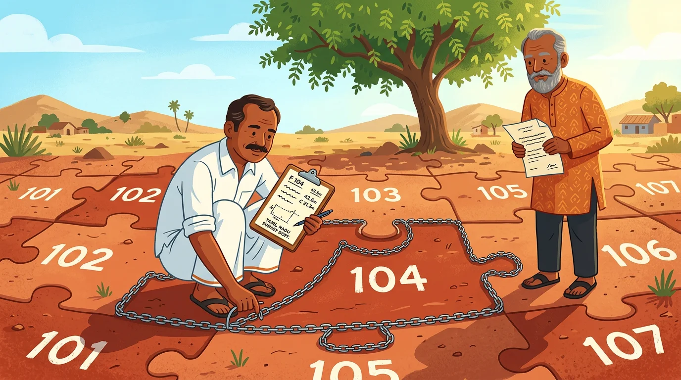
Every piece of land in India has a survey number, assigned when the British government surveyed the country’s land in the 19th century. Think of India’s total land as a giant jigsaw puzzle. Each piece has a number painted on it. Survey number 553. Survey number 553/2. Survey number 105/1A.
When land was divided between family members, or sold in portions, the original survey number was cut into sub-divisions. The parent number 553 became 553/1, 553/2, 553/3. Each sub-division is still a piece of the puzzle, just smaller.
The FMB sketch is the official drawing of your piece. It shows:
- The exact shape of your parcel, drawn to scale
- The measurement of each side (originally in chains and links; now in metres)
- The survey numbers of your neighbours on all sides
- Any roads, paths, or irrigation channels that run along or through the boundary
- Government or common land (called poramboke) adjacent to your plot
- The total area, calculated from those measurements
This is a document the Survey Department makes and maintains. It is separate from the Patta (owned by the Revenue Department) and separate from your registered sale deed (owned by the Registration Department). All three departments hold different pieces of the same puzzle.
What LP Means
LP is one of those terms that means different things depending on which state you are in.
In Andhra Pradesh and Telangana, LP stands for Land Parcel. The two states use “FMB/LP” as a combined term for the survey record of an individual plot. On the Meebhoomi portal in AP and on Bhu Bharati in Telangana, you will see them listed together because they describe the same parcel from slightly different angles. The FMB is the measured sketch; the LP is the digital land parcel boundary in the GIS system. Together, they tell you where the land sits, what shape it takes, and what its neighbours are.
In Tamil Nadu, LP means something different: Layout Permission. When a developer buys agricultural land and wants to convert it into a residential layout, they need approval from the town planning authority (DTCP, or CMDA in Chennai). That approval comes with an LP Number. The LP sketch is the approved drawing of the entire layout: the plot boundaries, road widths, open spaces, parks, drainage lines.
So in Tamil Nadu, if someone mentions an “LP sketch,” they are usually talking about a planned urban layout, not the survey map of a single rural parcel (which is still called the FMB sketch). If someone in AP or Telangana mentions “FMB/LP,” they mean your individual parcel’s survey record.
What an FMB Sketch Actually Looks Like
A typical FMB sketch is not an elaborate document. It is a technical drawing that fits on a single page, with a header and a diagram. The header tells you which district, taluk, firka (a revenue sub-district), and village the land belongs to, along with the survey number and sub-division, and the patta number.
Below the header is the drawing itself. Your plot is drawn as a polygon, with each side labeled with its measurement. North is indicated with an arrow. Adjacent features are labeled: “Road,” the neighbouring survey number, “Channel,” “Poramboke.” If your survey number has been sub-divided into multiple pieces, the sketch shows the internal sub-division lines too, with each sub-parcel’s area noted.
At the bottom, the Firka Surveyor (the officer responsible for your area) has signed and stamped it.
Tamil Nadu alone has approximately 55.20 lakh (5.5 million) of these sketches. As of 2024, all of them have been digitised and brought online.
Why the Sketch Matters in Disputes
In a civil court, an FMB sketch is not just a reference document. It is primary evidence. Under the Tamil Nadu Survey and Boundaries Act, 1923, a survey record is treated as conclusive proof that boundaries have been correctly determined - unless challenged and overturned by a civil court decree within the prescribed period.
When neighbours fight over a wall, a path, or a strip of land, the first thing an Advocate Commissioner (a court-appointed expert) does is obtain the FMB sketch for the disputed survey numbers and physically verify whether the ground matches the drawing.
Indian Kanoon, the database of court judgments, returns over 1,700 results for “FMB sketch” across Indian courts, with the Madras High Court accounting for the large majority. The disputes are remarkably consistent in their structure.
In one 2017 case (V. Mahendran vs The District Collector, Madras HC), a landowner alleged that a cart track had been fraudulently inserted into his FMB-linked revenue records by quarry interests seeking road access. The Madras High Court, reviewing the Advocate Commissioner’s report and historical FMB records, upheld the revenue authority’s restoration of the track - illustrating how historical FMB sketches can override present-day claims. In another case, a public sector corporation drew the boundary of a canal through a private landowner’s plot, citing the FMB sketch as the basis. The landowner had to prove the sketch was being misread.
In a 2019 case (V. Perumal vs The District Collector, Madras HC), the court used the FMB sketch to confirm that “the land in S.No.488/14 shown in the FMB sketch is identical to current land area” - settling a land identity dispute by treating the FMB as the definitive reference. The sketch was the last word.
Increasingly, the cases are about digitisation errors. When millions of hand-drawn sketches were scanned and converted to digital records, some measurements were entered incorrectly, some sub-divisions were missed, and some boundary lines were shifted. The Madras High Court has seen a sharp rise in writ petitions seeking FMB rectification since digitisation - because an error in the digital FMB can cloud your title, block your loan application, or misrepresent your boundary in any future dispute.
The Four Tamil Nadu Land Documents and How They Fit Together
FMB is one of four core land documents in Tamil Nadu (and a similar set exists in AP and Telangana). Understanding how they relate to each other makes all of them easier to use.
The Patta is your name on the puzzle piece. The Revenue Department issues it. It says: this survey number and sub-division, of this extent, in this village, is in your name. It is not proof of absolute ownership (your registered sale deed does that), but it is the government’s administrative recognition that you are the holder.
The Chitta used to be a separate document that classified your land as wetland (nanjai) or dryland (punjai) and recorded land revenue amounts. Since 2015, Tamil Nadu has merged the Chitta into the Patta - they are issued together as a single document from the eservices portal.
The Adangal (Village Account No. 2) is the Village Administrative Officer’s record of what is happening on the land: what crop is being grown, whether it is leased to a tenant, the water source, any government liabilities. It matters for agricultural loans, crop insurance, and government scheme eligibility. It does not directly address boundaries.
The FMB sketch is the drawing. It is the Survey Department’s answer to: where exactly is this land, and what does it look like?
Here is the critical point: a Patta can say you own 50 cents (0.50 acres). The FMB sketch may show your parcel as 45 cents once correctly measured, with the other 5 cents actually belonging to a road that your neighbour has absorbed into their plot over the years. Without cross-checking both documents - and ideally, taking a physical measurement - you would not know.
For more on how revenue records work across different Indian states, the guide to 7/12 extracts, RTC, and Pahani covers the national picture in detail.
How to Get Your FMB Sketch
Tamil Nadu: Visit eservices.tn.gov.in. Under “Land Records,” select “View Patta/Chitta/FMB (Rural/Natham)” - the FMB sketch is included in this combined service. For urban areas, select “TSLR Extract” instead. Enter your district, taluk, village, survey number, and sub-division. The sketch downloads as a PDF, free of charge. No login required.
Tamil Nadu also has the TamilNilam Geo-Info app (by TNEGA, available on Android) where you can tap a point on a map and view the FMB sketch and Patta details for the survey number at that location.
Andhra Pradesh: Visit meebhoomi.ap.gov.in and select “LP Map/FMB/Village Map” from the records menu. Enter the district, mandal, village, and survey number.
Telangana: Visit bhubharati.telangana.gov.in and navigate to FMB/LP records. Bhu Bharati is Telangana’s current land records portal - it replaced the discontinued Dharani portal in 2025. If your land’s record has not yet migrated cleanly from the old Dharani entries, you may need to visit the Mandal Revenue Office for a certified copy.
For a certified copy with an official stamp - useful for bank loans or court proceedings - you will need to apply in person (or through a Power of Attorney) at the Taluk Office or through a Common Service Centre. Allow 3–7 working days.
If you manage Tamil Nadu property from abroad, the Tamil Nadu NRI property guide covers the full set of online portals available, including TNREGINET for Encumbrance Certificates and eservices for patta and FMB. For AP-specific records, see the Andhra Pradesh NRI property guide. For Telangana, see the Telangana Bhu Bharati guide.
What to Do With Your FMB Now
Download it, and then physically verify it.
Print the sketch and take it to the land. Walk the boundaries. Check whether the measurements on the sketch match the actual fences, walls, and markers on the ground. Check whether the adjacent features match: does the sketch show a cart track on the north side where you see one on the ground? Does it show a road of 6 metres where you see a road of 4 metres?
Then compare the sketch with your Patta. Does the extent (area) in the Patta match the area you can calculate from the FMB sketch measurements? If they diverge by more than a small rounding difference, investigate why.
If you find an error in the FMB sketch, do not wait. File a petition for correction at the Tahsildar’s office, supported by the correct measurements and, if needed, a fresh survey. FMB errors tend to compound: a wrong boundary on your sketch affects your neighbours’ sketches too, and any future sale or loan application built on the erroneous data will carry the problem forward.
For the broader context of how India’s property disputes begin with exactly these document gaps, and why they can stretch across decades, that post is a useful reference.
Related Reading
- Land Revenue Records: 7/12, RTC, Pahani, and What They Mean - How the revenue record system works across all Indian states
- Mutation, Khata, and Patta: The Document That Transfers Revenue Records - What happens to land records after a sale
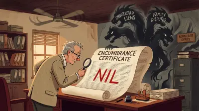
- Encumbrance Certificate: What It Shows and What It Misses - The other key title-verification document
- Managing Property in Tamil Nadu: An NRI Guide - Online portals, legal risks, and the K. Gopi ruling
- How to Protect Your Land From Encroachment - What to do when boundaries are disputed
- Beyond the Sale Deed: 5 Documents Most Owners Don’t Know They Need - Survey GIS maps, extent mismatch corrections, and other lesser-known documents
Assetly is a property document management platform that helps Indian property owners - including NRIs - organise, verify, and track their property documents digitally. Learn more at assetlyhq.com.