Vattinagulapalli Series: This is Part 1 of 3. Part 2: 7 Lessons Every Property Owner Should Know | Part 3: Family Land, Family Fights
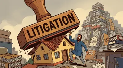
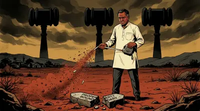
27 acres. Eight survey numbers. Original survey maps that the government admits do not exist.
That last detail is the one that matters. When Sunil Shah filed a writ petition in the Telangana High Court in 2019, the government made a remarkable admission: the Tippons (the original survey maps drawn when the land was first measured) for the disputed survey numbers are “not available.” Not lost temporarily. Not available. No baseline. No authoritative document showing where one plot ends and another begins.
Everything else in this story flows from that gap.
A compound wall was demolished at midnight by masked men with bulldozers. FIRs were filed by both sides. A revenue official who surveyed the land was later arrested in a ₹100 crore corruption case. Politicians visited the site. The land, which was agricultural scrubland a generation ago, is now estimated to be worth between ₹600 and ₹1,400 crore.
But strip away the drama and you are left with a document problem. An incomplete family partition. An ORR acquisition that cut through survey boundaries. And missing maps that make it impossible to resolve any of it.
The Land
Vattinagulapally is a village near Exit 1A of Hyderabad’s Outer Ring Road, in the western corridor that has become one of the city’s most valuable real estate belts. If you have driven on the ORR towards Gachibowli or the Financial District, you have driven past this land.
The dispute spans Survey Numbers 168, 169, 244, 245, 259, 261, 262, and 264. Together, these parcels are estimated to be worth somewhere between ₹600 and ₹1,400 crore, depending on who you ask and which valuation method you use. At current market rates of roughly ₹40,000 to 70,000 per square yard in the area (compared to ₹1.76 lakh per square yard at a recent Gachibowli auction just minutes away), these 27 acres represent a fortune. What was once agricultural land on the outskirts of Hyderabad is now surrounded by IT parks, gated communities, and commercial development.
Part of the reason for this transformation is GO 111, a 1996 government order that restricted construction within 10 km of Hyderabad’s Osmansagar and Himayatsagar lakes. Vattinagulapally was classified under this restriction for decades, which suppressed development and kept prices low. Then in April 2022, the Telangana High Court ruled that 948 acres across 87 land parcels in Vattinagulapally fell outside the catchment area, freeing them for development. GO 111 itself was fully scrapped in May 2023. Land that had been frozen for a generation was suddenly some of the most valuable real estate in Hyderabad.
That transformation in value is central to understanding why this dispute exists. When land is worth a few lakhs, families find a way to coexist. When the same land is worth hundreds of crores, every inch of boundary becomes a battle.
Timeline of Events
1969: The Shah family claims possession of the land begins. The patriarch, Damodar Das Shah, was a businessman based in Banjara Hills, Hyderabad. His sons, including Sunil, Sudhir, and likely Satish, would go on to hold parcels across multiple survey numbers in Vattinagulapally.
2005: Sunil D. Shah (one of Damodar Das’s sons) acquires 8 acres in Survey Number 168 via a registered Gift Settlement Deed.
2019: Sunil Shah files a writ petition (WP 13554/2019) in the Telangana High Court, challenging a proposed survey of Survey Numbers 169 and 245. During the proceedings, the government makes a remarkable admission: the Tippons are not available for these survey numbers. The case is eventually dismissed, but that admission is significant.
2020: Satish Kumar G. Shah, the pattadar (the person recorded in government revenue records as the landowner) of Surveys 261, 264, 244, and 245, challenges HMDA’s ORR acquisition notification in the High Court. The court directs HMDA to give him a personal hearing.
October 2025: K. Srinivasulu, the Assistant Director of Survey, Settlement & Land Records for Ranga Reddy District, is arrested by the Anti-Corruption Bureau (ACB) in a ₹100 crore disproportionate assets case. He is the official who reportedly conducted the disputed survey of these lands around 2018, during the then-TRS (now BRS) government. His arrest was part of a broader anti-corruption sweep by the Telangana ACB, which registered 199 cases and arrested 273 officials in 2025 alone, detecting disproportionate assets worth ₹96 crore across the state. In his case specifically, investigators seized a flat, a rice mill, 22 acres of agricultural land, 7 plots, 1.6 kg of gold, and two vehicles. The fact that the official who surveyed this land was later found to have assets wildly disproportionate to his income raises obvious questions.
29 November 2025, midnight: Approximately 70 masked men arrive with 4-5 JCBs and demolish a compound wall, a cowshed, and other structures on the disputed land. Staff present at the site are reportedly assaulted.
30 November 2025: A counter-complaint is filed by Akshay Shah.
3-4 December 2025: Two FIRs are registered at Gachibowli Police Station. Raghava Constructions (India) Pvt Ltd, a firm owned by Ponguleti Harsha Reddy (son of Telangana Revenue Minister Ponguleti Srinivas Reddy), is named as the 7th accused in one of the FIRs. BNS charges are filed.
8 December 2025: Inspector Habibulla Khan, the officer who registered the FIR, is transferred.
March 2026: A BRS delegation visits the site and meets the Governor. Avinav Shah, one of the family members on the other side, describes it publicly as a “family dispute.”
What Both Sides Say
This is a dispute within a family, but the two sides tell very different stories.
Pallavi and Satish Shah’s account
Pallavi Shah and Satish Kumar Shah say the family has owned this land since 1969. They claim the property has been attacked five times, that they have received death threats, and that a survey was conducted on their land without proper notice. They point to the Telangana High Court suspending the disputed surveys. The midnight demolition of their compound wall, they say, was a violent attempt to grab land by force.
Avinav, Akshay, and Sudhir Shah’s account
Avinav Shah, Akshay Shah, and Sudhir Shah describe this as an internal family boundary dispute. They say they have been seeking a proper survey since 2020 to establish correct boundaries. They deny any political angle and deny any involvement of Raghava Constructions.
The government’s response
Revenue Minister Ponguleti Srinivas Reddy has stated: “whoever is guilty will be punished.”
A note on Raghava Constructions
For context: Raghava Constructions (India) Pvt Ltd was incorporated in December 2019 and is owned by Ponguleti Harsha Reddy, the son of sitting Telangana Revenue Minister Ponguleti Srinivas Reddy. The firm has an authorised capital of ₹300 crore and is registered in Banjara Hills, Hyderabad.
Raghava Constructions denied involvement through a public statement. The South First has verified, however, that the FIR filed at Gachibowli Police Station names Raghava Constructions as the 7th accused. Being named in an FIR is not a finding of guilt. It is the starting point of an investigation, not its conclusion.
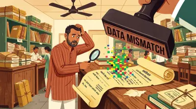
What Government Records Actually Show
This is where things get interesting. Pulling the Bhu Bharati records for the disputed survey numbers shows what Telangana’s official land records portal actually says about ownership.
Survey 245: the core disputed land
This is the survey number at the heart of the dispute. Bhu Bharati shows:
- 245/ఆ1: Pallavi S. Shah (Khata 941), 3 acres, classified as Agriculture Lands, father/husband listed as Satish Kumar. The record is marked “Digital Signed.”
- 245/అ/1, 245/ఆ2: Priyanka Shah (Khata 942)
- 245/అ/2, 245/ఆ3: Radika Shah (Khata 943)
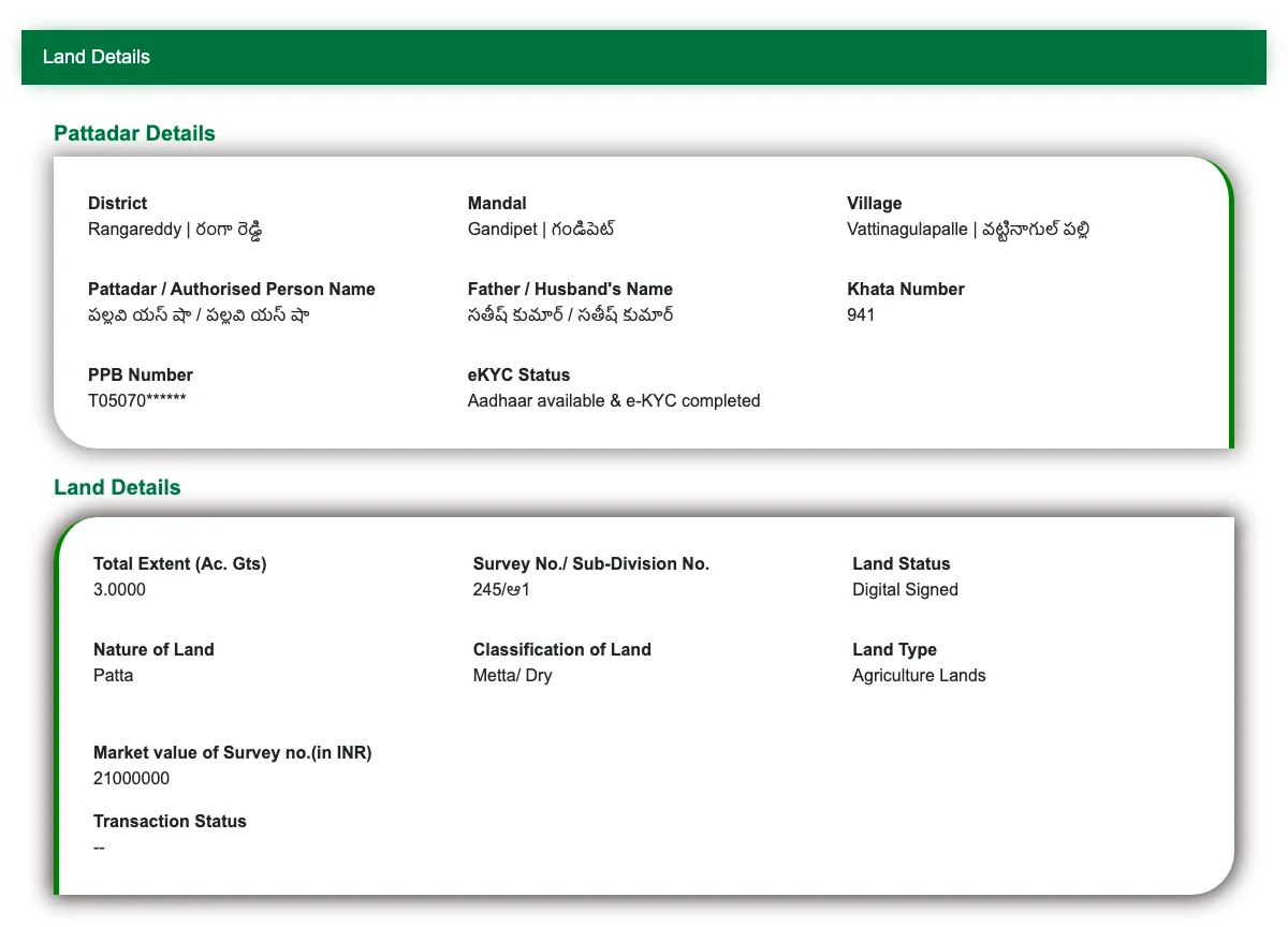
The portal entry for Survey 245/ఆ1 shows Pallavi S. Shah as pattadar with father/husband name Satish Kumar, classified as Agriculture Lands. These are the official revenue records as they stand today.
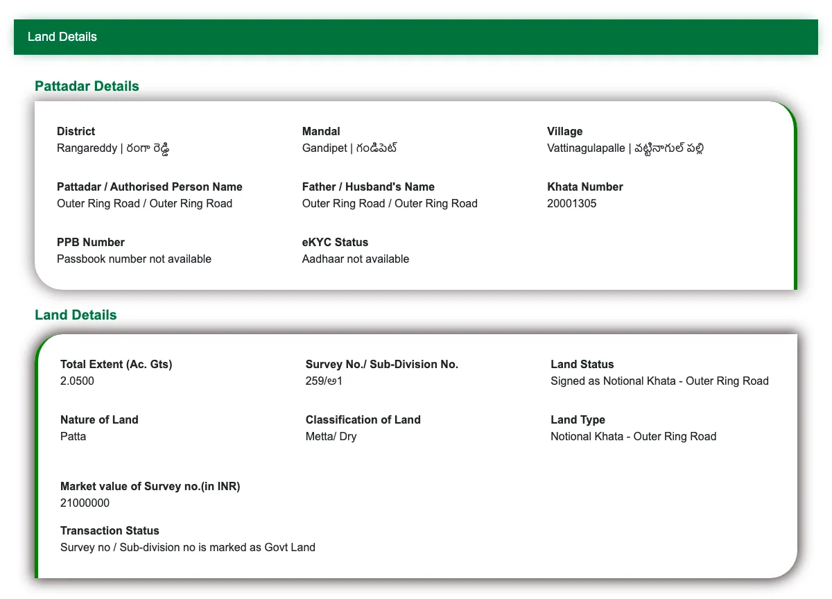
Survey 259: mostly ORR government land
Survey 259 tells a different story. Most of the subdivisions are recorded under “Outer Ring Road” (Khata 20001305): government-acquired land that was carved out for the ORR. But several private holdings remain:
- 259/అ4/1: Apoorva Shah (Khata 947)
- 259/అ2/1/3: Akshay Kumar Shah (Khata 945), the counter-complainant
- 259/అ2/3: Sudhir Shah (Khata 61214), one of the family members presenting the counter-narrative
- 259/అ5/3: Amrit Shah (Khata 948)
Both sides of the dispute hold recorded land in adjacent survey numbers. Akshay Shah, who filed the counter-complaint, is a registered pattadar in Survey 259. So is Sudhir Shah. These are not outsiders. They are family members with their own recorded holdings, which makes this dispute more complex than a simple land-grab narrative.
Other survey numbers
- Survey 168: Sunil Kumar D. Shah (Khata 1155) + Apoorva Shah + ORR government land
- Survey 169: Pallavi Shah + ORR + third parties
- Survey 244: Pallavi Shah + EVERBLOOMING AGRITECH PVT LTD + third parties
- Survey 261: Satish Kumar (Khata 287)
One extraordinary detail: Survey 169 has an 11-level subdivision depth (169/ఉ/1/1/1/1/1/1/1/1/1/1/1). That is a single survey number subdivided eleven times. This kind of extreme fragmentation is a visible symptom of what happens when land is repeatedly partitioned informally, partially acquired by the government, and carved up over decades without clean records.
What Court Records Tell Us
A search of Indian Kanoon returns over 180 indexed higher court judgments mentioning Vattinagulapalli. Digging through these reveals several things about the Shah family and their landholdings.
The family connection. ITAT records from 2019 confirm that Sunil D. Shah and Sudhir D. Shah are brothers, both sons of Late Damodar Das Shah. Apoorva Shah is Sunil’s son. Satish Kumar G. Shah (who uses a different middle initial) is also part of the family, though his exact relationship to Sunil and Sudhir is not stated in any court filing. His wife, Pallavi Shah, is the complainant in the current FIR. The family operated collectively as the “Shah Group,” sharing landholdings and entering into joint development agreements. All lived in the same house in Banjara Hills, Hyderabad, according to the ITAT judgment, though in different rooms and floors.
The current dispute has split the family into two factions. On one side: Satish and Pallavi Shah, who hold land primarily in Survey 245. On the other: Sudhir Shah, Avinav Shah, Akshay Shah, and Amrit Shah, who hold land primarily in Survey 259 and are associated with a firm called NewGen Developers.
Financial history. ITAT (Income Tax Appellate Tribunal) cases involving the family’s land transactions revealed “white and black” payment components, meaning declared and undeclared portions of sale consideration. This is not uncommon in Indian land transactions, but it is documented in the tribunal records.
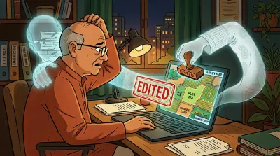
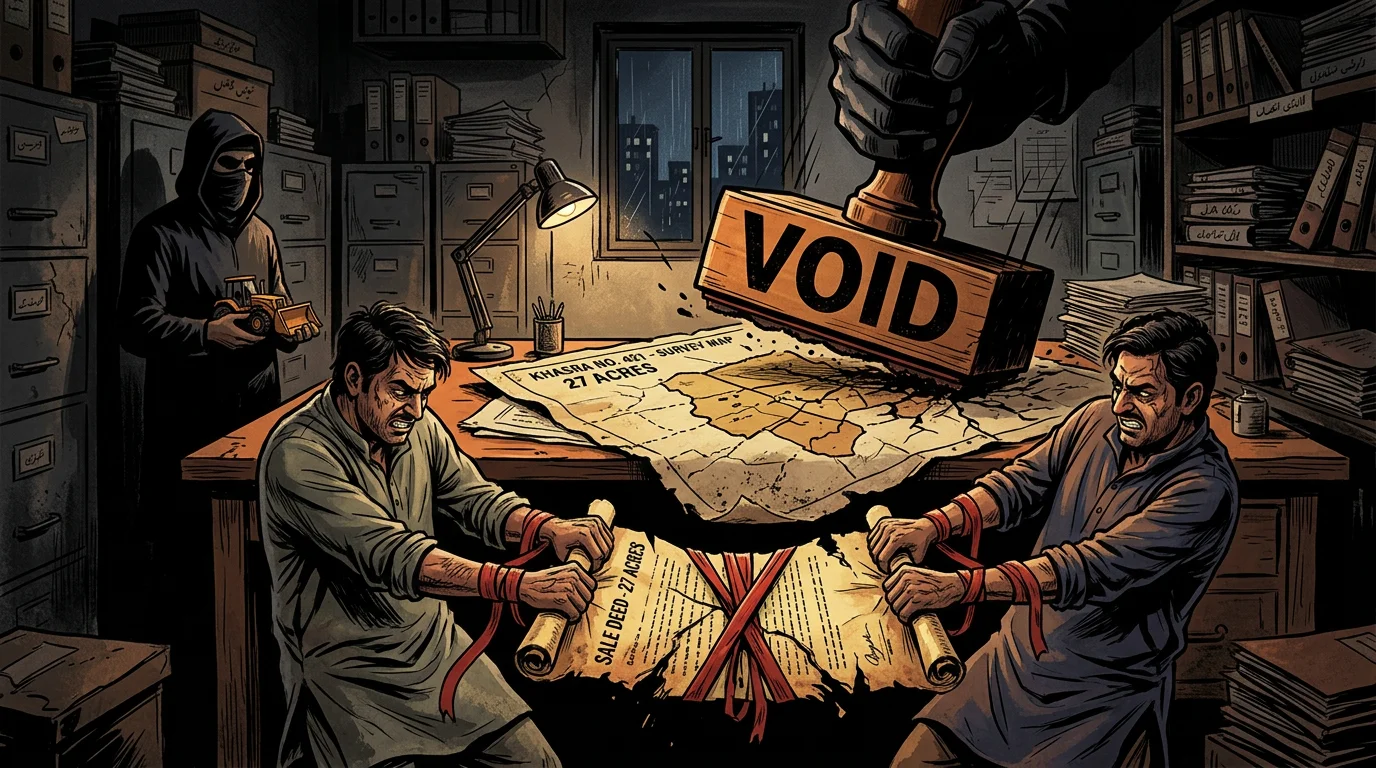
The missing Tippons. In WP 13554/2019, the Telangana government admitted that Tippons do not exist for the disputed survey numbers. This is arguably the single most important fact in this entire dispute. Tippons are the original survey maps prepared during the first land survey of a village. They are the foundational reference for plot boundaries. Without them, there is no authoritative document showing where Survey 245 ends and Survey 259 begins.
Think of it like a neighbourhood where every house has a deed, but nobody has the original master plan showing which deed corresponds to which plot. Every owner can wave their papers and say “this is mine,” but when two owners claim overlapping areas, there is no referee.
The arrested official. Srinivasulu, the revenue official who conducted the disputed survey, was subsequently arrested by the ACB in a ₹100 crore disproportionate assets case. His survey work is precisely what both sides dispute, and his arrest casts a shadow over the integrity of any survey he conducted.
Why This Dispute Exists: Four Layers
Most land disputes have a single cause. This one has four, layered on top of each other, each making the others worse.
Layer 1: Incomplete family partition
The Shah family held land collectively across Vattinagulapally for decades. As the family grew, land was divided, but informally. Oral agreements, informal understandings, parcels distributed among ten or more family members without registered partition deeds that cleanly assign specific survey subdivisions to specific people.
This is India’s property crisis in miniature. When families grow and property is divided through conversation rather than documentation, the seeds of a dispute are planted decades before anyone starts fighting.
Layer 2: ORR acquisition fragmented the land
When the Outer Ring Road was built, the government acquired portions of the Shah family’s land through HMDA. The ORR did not follow survey boundaries. It cut through plots, leaving odd-shaped remnants. Survey 259 is a perfect example: most of it is now “Outer Ring Road” government land, with Shah family parcels scattered around the edges.
This kind of acquisition creates boundary confusion. The land that remains is not the same shape or size as what was originally held. Without updated surveys and fresh maps, nobody is quite sure where the new boundaries are.
Layer 3: Missing Tippons (the root cause)
Without the original survey maps, there is no baseline to resolve boundary disputes. The government itself admitted this in court. When someone says “my land extends to here,” the natural response is “show me the map.” But the map does not exist.
This is not unique to Vattinagulapally. Across Telangana, land records carry errors and gaps inherited from decades of incomplete digitisation. In this case, though, the missing records are not just a bureaucratic inconvenience. They are the reason the dispute cannot be resolved.
Layer 4: Skyrocketing values
What was barren agricultural land on the outskirts of Hyderabad is now worth hundreds of crores. When land is cheap, families tolerate fuzzy boundaries. When the same land could fund a small corporation, every metre matters. The ORR turned Vattinagulapally from a village into premium real estate, and that transformation turned a dormant family disagreement into an active war.
What This Means for You as a Property Owner
The Vattinagulapalli dispute is dramatic: masked men, midnight demolitions, political delegations. Strip away the drama and the underlying problems are ordinary. They are the same problems affecting millions of properties across India.
Incomplete partitions. If your family has divided property informally, without registered partition deeds, you have the same vulnerability. Get the partition documented and registered before land values force the issue.
Missing or unclear boundaries. If you do not have a certified survey report for your property, you face the same risk as the Sandhar case, where an owner lost in three courts because he could not prove where his property ended and his neighbour’s began.
Unmonitored land. A compound wall was demolished overnight. If nobody is watching your property, encroachment can begin without your knowledge and the clock on adverse possession starts ticking. For NRIs especially, monitoring your digital land records is not optional. It is the minimum.
What Happens Next
Both FIRs are under investigation. The Telangana High Court has suspended the disputed surveys. The political fallout continues, with opposition parties using the case to question the ruling government’s handling of land disputes.
The underlying problem, though, remains unsolved. Until someone produces an authoritative survey (one that all parties accept and a court endorses) the boundaries will remain disputed. And without Tippons, producing that survey is harder than it should be.
For property owners watching this unfold, the lesson is clear: do not wait for a dispute to force you into action. Check your records. Get your boundaries surveyed. Document everything. Store it where you can access it from anywhere. Assetly exists precisely for this: helping property owners organise and track their documents digitally, so that when a dispute arises, the paperwork is already in order.
The Shah family has been in court since at least 2019. The dispute predates that by decades. The time to sort out your property documents is before they become evidence in a courtroom.
Assetly (assetlyhq.com) helps Indian property owners organise, verify, and track their property documents digitally, from anywhere in the world.