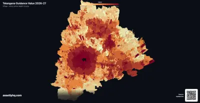

Imagine you have found the plot. The price is agreed, the advance is paid, and you walk into the Sub-Registrar’s office to get the sale deed done.
The clerk types in your survey number. Something red comes up on the screen. And he tells you, politely, that he cannot register it.
Not today. Not until somebody sorts out the entry sitting against that number.
Maybe that takes a few weeks. Maybe the flag is plain wrong and comes off after a correction. Maybe only part of the survey number is actually affected and it needs a closer look before registration can go ahead. Or maybe the land genuinely falls in a barred category and it stays that way.
You will not know which of those it is until you go and find out. What you do know is that today, the deed is not getting registered.
That is what a Section 22A flag does. And we wanted to know how many acres in Telangana are sitting behind that closed counter right now.
So we checked. Every single village.
How much land in Telangana is prohibited?
Over 16.25 lakh acres carry a prohibited flag, out of roughly 1.75 crore acres of recorded extent. That is about 9 percent.
One acre in every eleven.
Telangana keeps its village land records on a portal called Bhu Bharati (which replaced Dharani). Between the prohibited-property check and the pattadar index, which is the register of who owns how much, the state publishes enough to answer a question nobody seems to have asked: not how many survey numbers are flagged, but how much land that adds up to.
So we built that picture, village by village, across all 10,890 revenue villages in the state. Here is what came out.
What does prohibited land mean in Telangana?
Think of Section 22A as a barricade at the registration counter, not a claim on your land.
The state can notify categories of land whose registration is barred. Government land, forest, endowment property, assigned land given to landless families, land tied up in a court case. Once a survey number is on that list, the Sub-Registrar must refuse to register it. The fix does not happen at the counter. It happens through the revenue department, by getting the entry itself corrected or cleared.
But here is the important bit, and people get this wrong constantly.
A flag is not a finding of fraud, and it does not by itself say that your title is fake. Some entries reflect a legitimate government restriction: land may have been acquired, or be affected by an irrigation, reservoir, road or other public project. Compensation or acquisition proceedings may still be under way. Other entries need correction because only part of a survey number was affected but the whole number was flagged.
What that means for ownership and compensation depends on the reason behind the entry. The flag tells us only that registration is restricted. It does not tell us whether the restriction is an error, a temporary consequence of an ongoing process, or the record working as intended.
One more thing before the numbers. Everything you are about to read is a share of what is recorded in Bhu Bharati, which covers agricultural land, assigned land and NALA-converted parcels. It does not cover urban municipal property. So flats, approved layout plots inside municipal limits and gram kantam houses are largely outside this dataset. When we say 9 percent, we mean 9 percent of the village register, not of all land in Telangana.
Why the 22A list covers over one crore acres
You might have seen headlines about a revised 22A list covering over one crore acres. Ours says 16 lakh. Both are right. They are counting different things.
Of that one crore, roughly 77 lakh acres is government, assigned, forest, endowment, irrigation and road land. The bulk of that never sat inside an ordinary private holding, so most of it does not show up in the pattadar register at all. Another 18 lakh acres or so is agricultural land with no pattadar passbook, and about 3 lakh is NALA-converted land.
What we measured is the slice that still appears inside recorded pattadar holdings: land with an extent, a pattadar name against it, and a flag. That can include land affected by acquisition or a government project where the record has not yet been split cleanly between the affected extent and the pattadar’s remaining land.
That is the part a buyer or an owner runs into in the register. It is not necessarily a measure of disputed private ownership.
Is prohibited land mostly assigned land?
Our working theory was simple: this is mostly assigned land.
Assigned land is granted by the state to landless families, and it is non-transferable by law. So of course it would be flagged. If assigned land turned out to be driving the whole total, then “9 percent of recorded land is locked” would be technically true but fairly meaningless. It would just be the law working as designed.
We checked.
| Land type | Flagged acres | Share of that type flagged | Share of all flagged land |
|---|---|---|---|
| Agricultural land | ~12.9 lakh | 8.8% | 79.2% |
| Assigned land | ~2.7 lakh | 11.1% | 16.5% |
| NALA (converted) land | ~70,000 | 22.3% | 4.3% |
| Notional khata and other | negligible | 0.1% | 0.0% |
Nope.
Assigned land is barely a sixth of it. Nearly four-fifths of the flagged extent is plain, ordinary agricultural land. Roughly 13 lakh acres of farmland that somebody holds a passbook for.
NALA land is flagged more than any other category
Look at that middle column again.
NALA land is flagged at over 22 percent. More than one acre in five.
NALA means agricultural land that has been converted for non-agricultural use. Which is to say: the land that gets sold as plots. The land in the brochure. The land with a compound wall and a board and a site office.
Agricultural land sits at under 9 percent. Assigned land at 11 percent. The development-ready stuff is flagged at more than double the farmland rate.
So the category a buyer is most likely to be shown is also the category most likely to be locked.
That is the finding that should make you check before you pay anything.
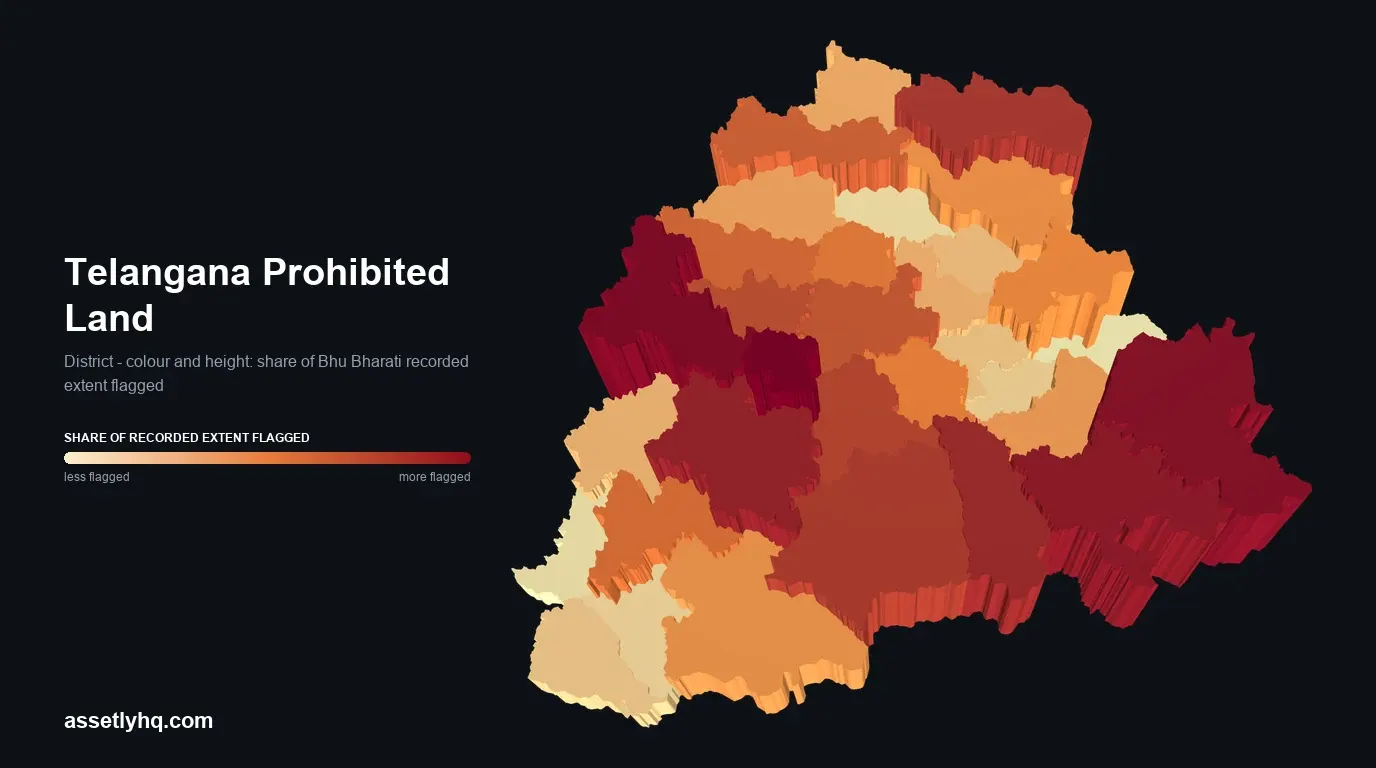
Telangana prohibited land by district
Now, where is this land?
| District | Flagged acres | Share of recorded extent |
|---|---|---|
| Medchal-Malkajigiri | ~34,000 | 19.8% |
| Sangareddy | ~1.5 lakh | 16.5% |
| Bhadradri Kothagudem | ~75,000 | 15.1% |
| Rangareddy | ~1.46 lakh | 14.1% |
| Khammam | ~1.1 lakh | 14.0% |
| Suryapet | ~82,000 | 11.7% |
| Kumuram Bheem (Asifabad) | ~52,000 | 11.6% |
| Nalgonda | ~1.48 lakh | 11.0% |
Three of the top four wrap around Hyderabad.
And if you strip out assigned land entirely and look only at agricultural land, it gets sharper. Medchal-Malkajigiri climbs to 25 percent. Sangareddy sits at 15 percent, Rangareddy at 14.
Mandals with the most 22A flagged land
Zoom into the mandals and it stops being abstract:
| Mandal | District | Agricultural land flagged |
|---|---|---|
| Ramachandrapuram | Sangareddy | 53.7% |
| Uppal | Medchal-Malkajigiri | 51.3% |
| Serilingampalle | Rangareddy | 51.2% |
| Palwancha | Bhadradri Kothagudem | 44.0% |
| Quthbullapur | Medchal-Malkajigiri | 43.8% |
| Ameenpur | Sangareddy | 43.6% |
| Keesara | Medchal-Malkajigiri | 35.0% |
| Patancheru | Sangareddy | 34.3% |
Uppal. Serilingampalle. Ameenpur. Keesara. Patancheru.
These are not obscure corners of the state. These are the names in the plot advertisements. And in several of them, more than half the agricultural extent on the register cannot currently be registered.
Now, we are not saying the growth ring somehow causes the flags. The honest explanation is duller and sadder. Peri-urban land carries a much denser history than farmland far from a city: assignments, acquisitions, endowments, old court cases, decades of paperwork piling up on the same parcels that later turned valuable. The flags are the residue of that history.
But the practical consequence stands on its own. The places with the most buying activity are the places where a registration bar is most likely.
Two districts break the pattern completely. Bhadradri Kothagudem and Kumuram Bheem Asifabad are nowhere near the growth ring, and both sit high on the list. Both are heavily forested Scheduled Area districts, so forest boundaries and tribal land protections are the obvious suspects, though our data records the flag and not the reason behind it. Either way, the map is not one story.
Does a high district percentage mean your property is affected?
Here is the trap.
You look up your district, see 14 percent, and think you have a one in seven chance of trouble. That is not how it works, because averages hide everything interesting.
Across the villages we measured:
- Around 800 villages carry no prohibited entry at all
- More than 4,200 villages sit below 5 percent
- Roughly 2,350 villages between 5 and 10 percent
- Roughly 2,330 villages between 10 and 25 percent
- Nearly 700 villages between 25 and 50 percent
- Over 150 villages above 50 percent
At the far end, Doulapur in Papannapet mandal of Medak district is flagged across every single acre of its recorded extent. Rekula Gadda in Chandampeta mandal, Nalgonda, is at almost 99 percent.
So a district at 14 percent might be an even spread. Or it might be a handful of almost completely locked villages surrounded by perfectly clean ones.
A district number tells you how carefully to check. It tells you nothing about your parcel.
What this prohibited land data cannot tell you
We would rather say this ourselves than have the numbers quoted without it.
It is a snapshot. One pass over the register. Entries get added and removed all the time. Anything you rely on for an actual transaction has to come from the live portal on the day.
It is not a verdict on anybody’s land. A flag may reflect a valid restriction, including acquisition or the impact of a government project. It can also be too broad or wrong, such as when a whole survey number is flagged even though only part was acquired. Bhu Bharati has a dedicated grievance process for separating the acquired extent from the pattadar’s remaining land.
It measures the register, not the ground. Land outside Bhu Bharati, including most urban municipal property, is not in here at all.
It undercounts slightly. Nearly 99 percent of flagged survey numbers matched a recorded extent. The small remainder are real flags whose acreage is missing from our total.
It does not tell you why. The dataset records the flag, not the full administrative history behind it. Whether land is government-owned, acquired for a project, assigned, endowed, affected by litigation or included by mistake changes what the entry means and what remedy, if any, applies.
It is only one of two registers. Properties tied up in litigation sit on a separate court-cases list, which covers urban property as well as farmland. We measured that one too, and nearly half of Telangana’s villages carry an entry.
The same belt shows up in a third register. Of the 9.87 lakh municipal LRS applications we measured, 1,23,801 are frozen behind an FTL or prohibited flag, and the heaviest concentrations sit in Shamshabad, Ameenpur, Meerpet and Boduppal. Different scheme, different department, same ring of land around Hyderabad.
How to check if your land is in the 22A prohibited list
If you own land in Telangana, or you are about to buy some, the useful moves are narrow and specific.
Check the survey number, not the village. Subdivisions behave differently from their parent. Use the number on your deed, EC, layout approval or revenue record. Nothing else.
Check before the money moves. Not after the agreement, not on the day of registration. A flag discovered at the counter is a stalled deal and an advance you now have to argue about.
If a flag shows up, find out which category it is. The fix for a court-case entry is not the fix for an assigned-land entry.
If you think it is wrong, there is a route. Bhu Bharati ROR Corrections has a grievance type for wrongful inclusion in the prohibited list. Our guide on removing a property from the 22A list walks through it.
Re-check now and then, especially if you are not around. Status changes and nobody calls to tell you. That matters most if you are abroad, in another city, or relying on family to keep an eye on things.
And do not read a clean result as a clean title. No 22A flag means no matching entry in the registers checked. That is all. Your title still depends on the encumbrance certificate, the chain of deeds, the revenue records and whether anyone is currently suing over it.
The land is not going anywhere. But your ability to sell it on the day you want to might not be there, and a flag is far easier to sort out with months in hand than with a buyer waiting at the counter.
Which is a strange thing to find out at a counter.
Method and data sources
Everything here is built from Telangana’s own published land records: the Bhu Bharati prohibited-property check for the flags, and the pattadar index for the extent behind them. Coverage is the full state, over 17 lakh flagged survey numbers across 9,730 villages in 32 districts and 605 mandals. Villages returning no entries were recorded as confirmed clean rather than dropped, which matters, because treating them as missing would have inflated every percentage on this page.
Nearly 99 percent of flagged survey numbers could be matched to a recorded holding, so the acreage totals are a slight undercount. Land-type shares use the register’s own classification. District and mandal aggregates cover the full measured set.
Hyderabad district is absent throughout. It has effectively no land in the agricultural register.
Assetly helps property owners organise their documents and keep track of changes like a Section 22A entry appearing against a survey number.