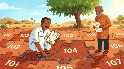


In March 2021, a Tahsildar reported that twelve acres in Survey No. 187 of Agapally village were government land, available and free from encroachment. The report supported the process that led to a quarry lease.
Four years later, another official survey looked at the same survey number and reached a materially different conclusion. It said that 3 acres and 20 guntas claimed by another person overlapped the quarry lease area.
Both reports carried official weight. They could not both settle the same boundary question. The second one also had a serious procedural defect: the quarry lessee had not been notified before officials went to the site and recorded the overlap.
On 3 September 2026, the Telangana High Court set that second report aside and ordered the authorities to begin again. The case, M. Sudhakar Reddy v. State of Telangana, is not simply a dispute involving a quarry. It explains what a lawful boundary survey requires, why an old revenue entry cannot by itself finish a title dispute, and what property owners should do when paper records and physical claims no longer line up.
The dispute inside Survey No. 187
The land is in Agapally village, Manchal Mandal, Ranga Reddy district. In 2021, the Mines and Geology Department asked the Tahsildar to examine land connected with a proposed quarry lease.
The first report, dated 27 March 2021, recorded that twelve acres in Survey No. 187 were government land and were available and free from encroachment. A quarry lease was subsequently granted over 3.230 hectares in 2022.
That was not the end of the parcel’s history.
In 2025, an objector asserted rights over 3 acres and 20 guntas in Survey Nos. 187/2 and 187/AA. He said the land had been assigned to his father around eighty years earlier. His claimed document trail included a title deed, 1-B certificate, mutation proceedings and Pahani entries, along with possession.
This was not merely a disagreement over an area calculation. The quarry lease referred to Survey No. 187, while the objector relied on subdivisions within that parent survey number. The dispute required officials to correlate the parent number, its subdivisions, the historical records and the location occupied on the ground.
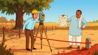
Officials conducted a joint survey on 23 September 2025. A report issued the next day concluded that the objector’s claimed land overlapped the quarry lease area. A panchanama and location sketch accompanied the finding.
The quarry lessee challenged the report. His central point was straightforward: nobody had given him prior notice of a survey capable of affecting his existing lease.
Why notice was not a formality
The High Court examined Sections 5, 6 and 10 of the Telangana Survey and Boundaries Act, 1923.
When the government orders a survey of government land or a boundary involving government land, the law provides for notification to people who have an interest in the land or boundary. They must have an opportunity to attend, point out the boundary they claim and supply relevant information. When a boundary is disputed, the Survey Officer must conduct an inquiry, determine the boundary, record reasons and notify the parties and affected registered holders of the decision.
The reason is practical. A survey is not just a technician measuring an empty field. One party may hold an old subdivision sketch. Another may rely on a lease plan. A neighbouring owner may know which stones were replaced. Revenue officials may possess a village map that does not align neatly with the current fence. Excluding an affected party removes documents and ground evidence from the exercise before the conclusion is written.
In this case, the government did not dispute that the quarry lessee received no prior notice. He could not attend, identify the area covered by the lease or place his records before the survey team.
The court held that this was not a minor technical defect. The survey’s purpose was to decide whether the objector’s claimed land overlapped an existing lease. A finding with that consequence could not validly be reached behind the lessee’s back.
The second report was therefore set aside.
The first report did not become permanently binding
The lessee also argued that the Tahsildar had already examined the land in 2021 and could not reopen the issue later. Lawyers describe this argument through the doctrine of functus officio: once an authority has finally exercised a power and made its decision, it may not be free to decide the same matter again unless the law permits it.
The High Court rejected that argument here.
The 2021 report answered a departmental request connected with the proposed quarry lease. It described the status shown in the records at that time. It did not adjudicate title against an identified competing claimant, and it did not finally settle every boundary within Survey No. 187.
The situation changed when the objector appeared in 2025 with a specific claim and historical documents. The Tahsildar was not barred from examining that new claim merely because an earlier report existed.
But permission to inquire again did not mean permission to skip the legal process. The court drew a careful line: the authorities could conduct another survey, but they had to notify and hear the people whose rights could be affected.
A fresh survey had to be genuinely fresh
An earlier single-judge order had already directed a fresh survey, but said it should be conducted “in consonance with” the 2025 report.
The Division Bench found that instruction internally inconsistent. If the 2025 report was defective because an affected party had been excluded, a new survey could not be required to conform to its conclusion.
The court ordered a survey de novo, meaning a new exercise from the beginning. Officials must notify the lessee, the objector and every other interested or affected person. They must let the parties participate and point out their claimed boundaries. The Survey Officer must consider the relevant survey and revenue records, physical features and material produced by the parties, record reasons, and communicate the decision.
The two earlier reports do not disappear. They remain documents in the official file and may be considered. But neither report can bind the Survey Officer or predetermine the result.
That is an important distinction for anyone requesting a resurvey. A new visit to the site is not a meaningful remedy if the authority treats the disputed old sketch as the answer it must reproduce.
What the court did not decide
The judgment did not declare the quarry lessee the owner. It also did not declare the objector the owner.
The objector’s title claim depended on facts that a boundary survey alone could not resolve: the legal effect of the alleged historical assignment, the evidentiary value of old revenue records, the mutation history, possession, and whether the claimed subdivisions corresponded to the leased land.
The High Court said those disputed questions were not suitable for summary determination in a writ proceeding. A civil suit, where parties can lead evidence and test each other’s claims, may be required to resolve title and possession.
Until the new survey and the competent authority’s decision, an earlier interim restraint on quarry operations over 1 acre and 30 guntas in Survey No. 187/2 was allowed to continue. Even then, the fresh survey’s findings were not to be treated as an adjudication of title.
This is the central lesson: a survey identifies land; it does not automatically decide who owns it.
An FMB sketch or land-parcel map can show the recorded shape, dimensions and neighbouring survey numbers. A field survey can test those records against the ground. A revenue entry can show who is recorded for fiscal and administrative purposes. Title may still depend on deeds, grants, inheritance, statutory restrictions and judicial findings that sit outside the measurement exercise.
What owners should do before an official survey
If a boundary survey can affect your land, do not arrive with only a photocopy of the latest deed. Build the parcel history before the survey date.
Obtain the complete notice and case file
Confirm which authority ordered the survey, the provision under which it is being conducted, the survey numbers and subdivisions in scope, and the time and location. Ask for the application or representation that triggered the exercise and copies of earlier reports being relied upon.
If you learn about the survey informally, submit a written request to participate. Preserve proof that the request was received.
Reconcile the identifiers
Write down every property identifier appearing across the records:
- Parent survey number and every subdivision
- Revenue village, mandal and district
- Extent and unit of measurement
- Four boundaries in the deed schedule
- Pattadar, assignor, lessor or predecessor names
- Mutation, passbook or khata references
- Coordinates or corner references, if available
Small differences can be decisive. Survey No. 187 is not interchangeable with 187/2 or 187/AA. A village name used locally may not be the revenue village recorded in the official map.
Put the documents in chronological order
Take the registered deed and link documents, any assignment or grant, mutation proceedings, current and historical Pahani or 1-B extracts, the FMB or village map, subdivision proceedings, previous survey sketches, panchanamas, photographs and correspondence.
The aim is not to overwhelm the Survey Officer with paper. It is to show how the parcel description changed over time and which document supports each claimed corner or boundary.
Attend the field exercise
Participate personally or through a properly authorised representative. Point out the physical features you rely on, such as boundary stones, roads, channels, walls and neighbouring holdings. Record who attended, which instruments and reference points were used, and which documents were accepted for consideration.
A private land surveyor can help you understand the mismatch and prepare a technical comparison. A private report cannot replace the official process or change the government record.
Ask for the reasoned result
Obtain the final report, sketch, measurement sheet and panchanama. The result should explain how the authority dealt with competing records and objections, not merely announce an overlap or a boundary line.
If the report decides a title question that the survey authority was not empowered to adjudicate, or if an affected person was excluded, take legal advice quickly. Survey statutes and appeal periods are state-specific, and delay can make the practical dispute harder even when the underlying objection remains strong.
Why this case matters beyond a quarry
The pattern appears in ordinary family and residential property disputes too.
A parent survey number is divided over decades. One branch of a family mutates its share while another relies on an older deed. A road shifts. A developer places a layout boundary against the wrong subdivision. A digitised parcel map does not match the paper FMB. An owner abroad discovers the problem only when a neighbour starts fencing or a buyer commissions a survey.
The Agapally case gives those owners a useful framework:
- An earlier administrative report is not necessarily a final title or boundary adjudication.
- Authorities may examine a later competing claim, but they must follow the prescribed procedure.
- Affected parties need a real opportunity to participate in a survey that can alter their position.
- A fresh survey must assess the records and ground position independently.
- Even a valid survey may leave title and possession for a civil court.
The right question is therefore not only, “What does the latest survey report say?” It is also, “Who was heard, which records were reconciled, what was measured, and what legal question was the officer actually authorised to decide?”
That is how two official surveys of one survey number become more than a contradiction. They become a warning about the difference between an entry, a measurement, a boundary decision and ownership itself.