
Where Telangana's Prohibited Land Is
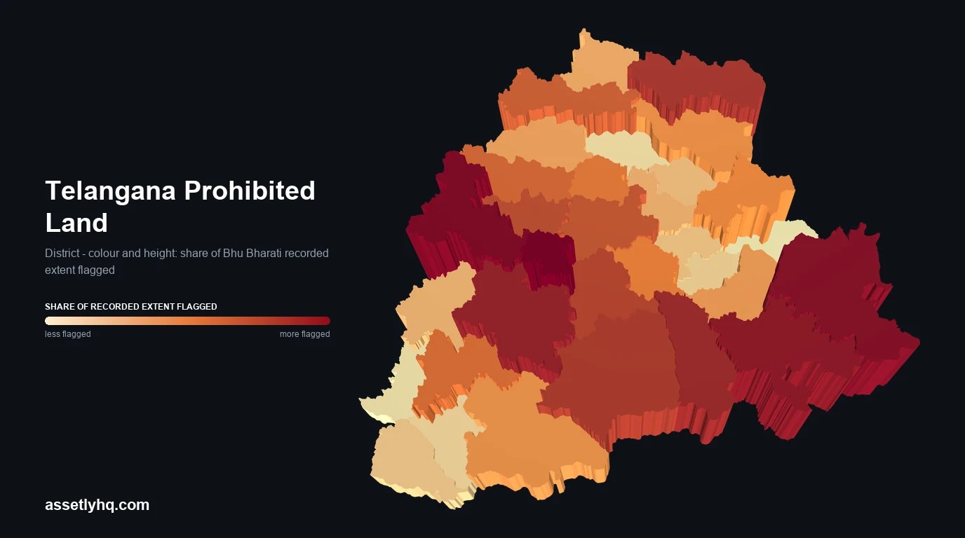
Section 22-A stops a Sub-Registrar from registering a sale. This map shows how much land carries that flag in every district, mandal and revenue village, from a statewide check run on 13 August 2026.
Every percentage here is a share of Bhu Bharati recorded extent, the village land register covering agricultural, assigned and NALA land. It is not a share of all land in Telangana, and it excludes urban municipal property.
- 16,25,256
- acres flagged
- of 1.75 crore acres recorded
- 9.26%
- of recorded extent
- across 32 districts
- 79.2%
- of flagged land is farm land
- assigned land is only 16.5%
- 22.3%
- of NALA land is flagged
- the most-affected category
The map draws 32 districts, 555 mandals and 9,780 villages. Coverage is limited by boundary geometry, which reaches 97.2% of measured extent, so a few areas are absent from the map even though they were measured. Areas with negligible recorded extent are withheld rather than shown as a percentage, because a share computed on a handful of acres is not a measurement of that area. For informational use only - confirm the current position on the government portal before any transaction.
This map cannot tell you about your land
A district or mandal figure is an average, and the spread inside it is enormous: 817 villages carry no flag at all, while 157 are above 50%. The number that matters to an owner is the one attached to their own survey number.
Check a survey numberQuestions
- What does this map show?
- For each district, mandal and revenue village, the share of land recorded in Telangana’s Bhu Bharati register whose survey numbers carry a Section 22-A prohibited flag. Colour and height both encode that share.
- Is this the share of all land in Telangana?
- No. The denominator is Bhu Bharati recorded extent, which covers agricultural, assigned and NALA-converted land. Urban municipal property such as flats and approved layout plots inside municipal limits is largely outside this register, and outside these percentages.
- Does a high percentage mean my property is affected?
- No. These are area aggregates and the spread inside a district is very wide. Only a check against your own survey number can tell you your parcel’s status.
- Does a prohibited flag mean the land was grabbed?
- No. It blocks registration at the Sub-Registrar’s office. It is not a finding of fraud. Genuine private land has been flagged in bulk when a parent survey number was listed without checking the subdivisions under it, and there is an official correction route.
- How current is the data?
- It is a single-pass snapshot of the Bhu Bharati prohibited-property check taken on 13 August 2026 across 10,890 villages. Entries change. Verify on the live government portal before any transaction.
Read the full analysis, including method and limits, in We measured Telangana's prohibited land, or start with the guide to Section 22-A and how to fix a wrong entry.